South Florida's future is looking soggy. A map from the nonprofit group Climate Central is making the digital rounds, laying out the stark reality that rising sea levels and flooding can make annual inundation a fact of life for many parts of the region by 2050. The projection isn't for some sci-fi dystopia generations away — it's just 25 years down the road, and the impacts could be massive for Miami neighborhoods and landmarks.
The map highlights the areas most at risk, using the latest data from the United Nations (UN) Intergovernmental Panel on Climate Change (IPCC), the National Oceanic and Atmospheric Administration (NOAA), and projections from climatologist Claudia Tebaldi and other experts in global climate change projections.
"[The maps] are showing a water level compared to local elevation," Peter Girard, Climate Central's vice president of communications, confirms in a phone interview with New Times. "And the inputs are a combination of sea level rise, which is what that NOAA study informs, and for the United States, that's the most recent assessment of sea level rise risk and elevation. And additionally, we're looking at peer-reviewed research that models what the expected heights of different types of coastal floods would be."
Girard — whose group has also provided locals with a graphical representation of Miami's hottest (as in degrees Fahrenheit) neighborhoods — emphasizes that this particular map represents annual flood risk, not permanent underwater doom.
"The risk selected is from an annual flood event. That's a coastal flood level expected to be reached, on average, at least once per year by 2025," he explains.
In other words, even if your neighborhood isn't Atlantis yet, frequent flooding could disrupt life — and property values — in ways that will be hard to overlook.
Spoiler alert: Coastal South Florida is in deep.
Everglades National Park, an ecological crown jewel, is projected to experience significant flooding. That could wreak havoc on the park's hundreds of bird, mammal, and reptile species, not to mention its role as a natural water filter for South Florida.
And while the City of Miami proper is unlikely to experience full-scale submersion, some areas will fare worse than others. Vizcaya Museum and Gardens, the historic estate that overlooks Biscayne Bay south of the Rickenbacker Causeway, looks like it's in for a rough time. Belle Meade, a quiet, leafy neighborhood on the city's Upper Eastside, likewise is projected to take a hit, owing to its proximity to the Little River.
Further north in Miami-Dade County, students at Florida International University's Biscayne Bay Campus might be kayaking to class — it might be its own little island at times by midcentury.
And up the road in Fort Lauderdale, things aren't looking any drier. Parts of the Las Olas Isles, an area known for its posh waterfront mansions, are projected to be partially submerged. For a city nicknamed the "Venice of America," rising tides could make that comparison a little too real.
According to the NOAA, sea levels along the U.S. coastline are expected to rise by ten to 12 inches by 2050. That might not sound like much, but beware the ripple effects. Storm surges, seasonal high tides, and other factors combine to push water further inland, imperiling low-lying areas.
"In addition to showing what sea levels are likely to look like, we can also show how far inland and how high coastal floods are likely to reach," Climate Central's Girard elaborates. "And we can look at anything from an annual coastal flood, and that's essentially the water level expected to be reached at least once a year."
Girard emphasizes that this nearly always happens during serious storms. Climate projectors can predict high-water levels during those events and then pinpoint areas where the land lies below those levels.
Low-lying areas that are connected to open water have the greatest potential for flooding, he says.
As the realities of rising sea levels become impossible to ignore, Girard notes, some South Florida communities are already taking steps to adapt. "You're seeing projects to elevate roadways and other steps to try to reduce the impact of rising seas."
While hopeful for South Floridians, Girard warns that the pace of sea-level rise is accelerating, leaving little time for complacency.
"Sea levels will continue to rise and will actually rise faster in the coming years, especially by the second half of this century," he says. "You're expected to see much more severe increases in the pace of sea-level rise — which means the defenses that are built and the decisions made to protect people and property need to incorporate higher and higher, not just tides at the new and full moon, but water levels that you'll experience during a storm."
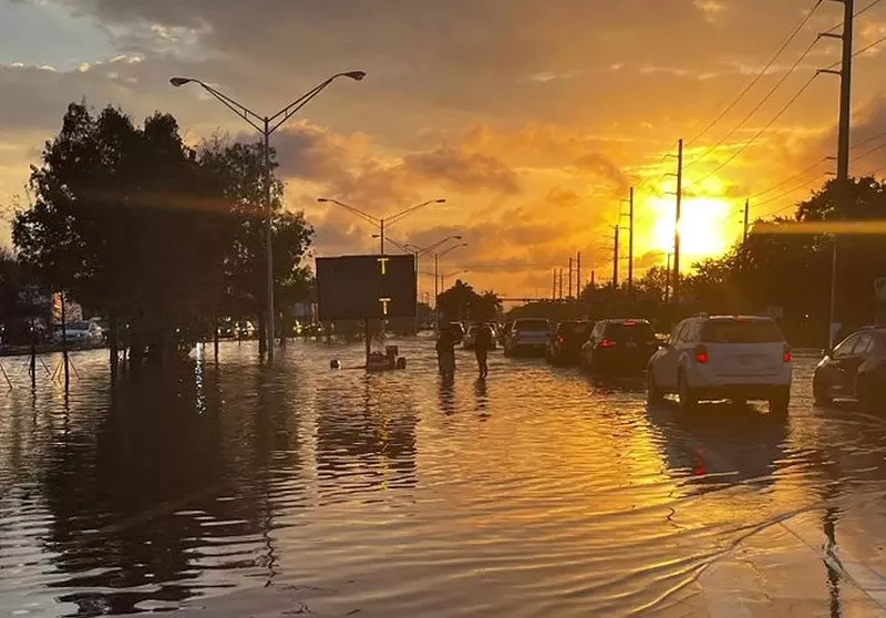
The sun rises over waterlogged Broward County after a night of historic rain in 2023.
Florida Department of Transportation (FDOT) photo

Audio By Carbonatix
[
          {
            "name": "GPT - Billboard - Slot Inline - Content - Labeled - No Desktop",
            "component": "22004575",
            "insertPoint": "2",
            "requiredCountToDisplay": "2"
          },{
            "name": "STN Player - Float - Mobile Only ",
            "component": "22595215",
            "insertPoint": "2",
            "requiredCountToDisplay": "2"
          },{
            "name": "Editor Picks",
            "component": "17482312",
            "insertPoint": "4",
            "requiredCountToDisplay": "1"
          },{
            "name": "Inline Links",
            "component": "18711090",
            "insertPoint": "8th",
            "startingPoint": 8,
            "requiredCountToDisplay": "7",
            "maxInsertions": 25
          },{
            "name": "GPT - Rectangle 2x - Slot Auto-select - Labeled",
            "component": "22004615",
            "insertPoint": "8th",
            "startingPoint": 8,
            "requiredCountToDisplay": "7",
            "maxInsertions": 25
          },{
            "name": "Inline Links",
            "component": "18711090",
            "insertPoint": "8th",
            "startingPoint": 12,
            "requiredCountToDisplay": "11",
            "maxInsertions": 25
          },{
            "name": "GPT - Leaderboard to Tower - Slot Auto-select - Labeled",
            "component": "17720761",
            "insertPoint": "8th",
            "startingPoint": 12,
            "requiredCountToDisplay": "11",
            "maxInsertions": 25
          }
        ]


Use of this website constitutes acceptance of our
terms of use,
our cookies policy, and our
privacy policy.
View our accessibility policy and AI policy.
The Miami New Times may earn a portion of sales from products & services purchased through links on our site from our
affiliate partners.
©2025
Miami New Times, LLC. All rights reserved.
Do Not Sell or Share My Information
Do Not Sell or Share My Information